
GIS Applications

Telecom and Network services
GIS can be an excellent planning and decision making tool for telecom industries. Hardcastle enables wireless telecommunication organizations to incorporate geographic data into the intricate network design, planning, optimization, maintenance, and activities. This technology allows telecom to enhance a variety of application like engineering application, customer relationship management, and location-based services..
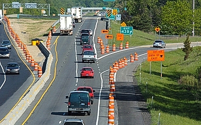
Accident Analysis and Hot Spot Analysis
GIS is used to minimize accident hazard on roads, the existing road network has to be optimized and also the road safety measures have to be improved. This can be achieved with proper traffic management. By identifying the accident locations, remedial measures can be planned by the district administrations to minimize the accidents in different parts of the world. Rerouting design is also very convenient using GIS..
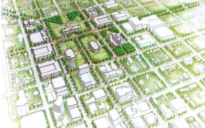
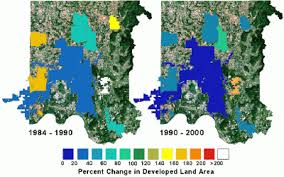
Urban Planning
GIS technology is used to analyze the urban growth and its direction of expansion, and to find suitable sites for further urban development. In order to identify the places ideal for the urban growth, certain factors have to consider which is: land should have proper accessibility, land should be more or less flat, land should be vacant or having low usage value presently, and it should have a good supply of water.

Transportation Planning
GIS can be used in managing transportation and logistical problems. If the transport department is planning for a new railway or a road route, then this can be performed by adding environmental and topographical data into the GIS platform. This will easily output the best route for the transportation based on the criteria like flattest route, least damage to habitats and least disturbance from local people. GIS can also help in monitoring rail systems and road conditions.
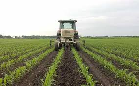
Agricultural Applications
GIS can be used to create more effective and efficient farming techniques. It can also analyze soil data and to determine: what are the best crop to plant? Where should they go? How to maintain nutrition levels to best benefit crop to plant?. It is fully integrated and widely accepted for helping government agencies to manage programs that support farmers and protect the environment. This could increase food production in different parts of the world so the world food crisis could be avoided.
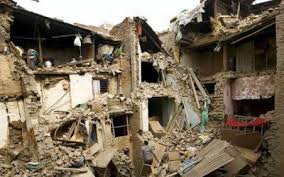
Disaster Management and Mitigation
Today, well-developed GIS systems are used to protect the environment. It has become an integrated, well developed, and successful tool in disaster management and mitigation. GIS can help with risk management and analysis by displaying which areas are likely to be prone to natural or man-made disasters. When such hazards are identified, preventive measures can be developed.
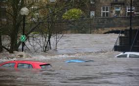
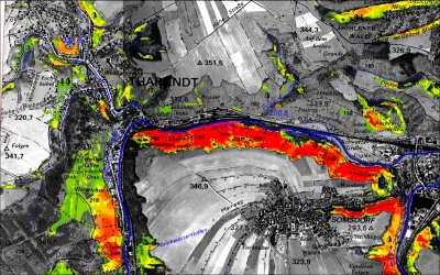
Flood damage estimation
GIS helps to document the need for federal disaster relief funds, when appropriate and can be utilized by insurance agencies to assist in assessing the monetary value of property loss. A local government needs to map flooding risk areas for evaluating the flood potential level in the surrounding area. The damage can be a reasonable estimate and can be shown using digital maps.
Natural Resources Management
Natural Resources Management: By the help of GIS technology, the agricultural, water and forest resources can be well maintained and manage. Foresters can easily monitor forest condition. Agricultural land includes managing crop yield, monitoring crop rotation, and more. Water is one of the essential constituents of the environment. GIS is used to analyze the geographic distribution of water resources. They are interrelated, i.e., forest cover reduces the stormwater runoff and tree canopy stores approximately 215,000 tons of carbon. GIS is also used in afforestation.

GIS solutions in the banking sector
GIS Solutions in Banking Sector: Today, rapid development occurs in the banking sector. So it has become more market-driven and market-responsive. The success of this sector largely depends on the ability of a bank to provide customer and market-driven services. GIS plays an essential role in providing planning, organizing, and decision making.

Soil Mapping
Soil Mapping: Soil mapping provides resource information about an area. It helps in understanding soil suitability for various land use activities. It is essential for preventing environmental deterioration associated with misuse of land. GIS Helps to identify soil types in an area and to delineate soil boundaries. It is used for the identification and classification of soil. A soil map is widely used by the farmers in developed countries to retain soil nutrients and earn maximum yield.
GIS-based Digital Taxation
GIS-based Digital Taxation: In Local Governments, GIS is used to solve taxation problems. It is used to maximize government income. For example, for engineering, building permits, city development, and other municipal needs, GIS is used. Often the data collected and used by one agency or department can be used by another. Example Orhitec ltd can supply you with a system to manage property tax on a geographic basis that can work interactively with the municipal tax collection department. Using GIS, we can develop a digital taxation system.
Land Information System
Land Information System: GIS-based land acquisition management system will provide complete information about the land. Land acquisition managements are being used for the past 3 or 4 years only. It would help in assessment, payments for private property with owner details, tracking of land allotments and possessions identification and timely resolution of land acquisition-related issues.
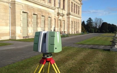
Surveying
Surveying: Surveying is the measurement of the location of objects on the earth’s surfaces. A land survey is measuring the distance and angles between different points on the earth surface. An increasing number of national and governments and regional organizations are using GNSS measurements. GNSS is used for topographic surveys where a centimeter-level accuracy is provided. These data can be incorporated into the GIS system. GIS tools can be used to estimate area and also, digital maps can be prepared.
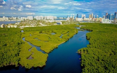
Wetland mapping
Wetland Mapping: Wetlands contribute to a healthy environment and retain water during dry periods, thus keeping the water table high and relatively stable. During the flooding, they act to reduce flood levels and to trap suspended solids and attached nutrients. GIS provides options for wetland mapping and design projects for wetland conservation quickly with the help of GIS. Integration with Remote Sensing data helps to complete wetland mapping on various scale. We can create a wetland digital data bank with spices information using GIS.

geology map
GIS Applications in Geology: Geologists use GIS in various applications. The GIS is used to study geologic features, analyze soils and strata, assess seismic information, and or create three dimensional (3D) displays of geographic features. GIS can also be used to analyze rock information characteristics and identifying the best dam site location.
Detection of coal mine fires
Detection of Coal Mine Fires: GIS technology is applied in the area of safe production of the coal mine. The coal mine has developed an information management system. The administrators can monitor the safe production of coal mine and at the same time, improve the abilities to make decisions. Fire frequently happens in coal mines. So it can assess spontaneous combustion risk using GIS tools.

Fire equipment response distance analysis
Fire equipment response distance analysis: GIS can be used to evaluate how far (as measured as via the street network) each portion of the street network is from a firehouse. This can be useful in assessing the best location for a new firehouse or in determining how well the fire services cover particular areas for insurance ratings.

Worldwide earthquake information system.
Worldwide Earthquake Information System: One of the most frightening and destructive phenomena of nature is the occurrence of an earthquake. There is a need to have knowledge regarding the trends in earthquake occurrence worldwide. A GIS-based user interface system for querying on earthquake catalog will be of great help to the earthquake engineers and seismologists in understanding the behavior pattern of an earthquake in the spatial and temporal domain.
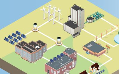
Energy use tracking and planning
Energy Use Tracking and Planning: GIS is a valuable tool that helps in the planning organizing and subsequent growth in the energy and utility industries. The effective management of energy systems is a complex challenge. GIS has enormous potential for planning, design, and maintenance of the facility. Also, it provides improved services and that too cost-effectively.

GIS for Fisheries and ocean industries
GIS for Fisheries and Ocean Industries: GIS tools add value and the capability to ocean data. ArcGis is used to determine the spatial data for a fisheries assessment and management system. It is extensively used in the ocean industry area, and we get accurate information regarding various commercial activities. To enhance minimizing cost for the fishing industry. Also, it can determine the location of illegal fishing operations.
Monitor rangeland resources
Monitor Rangeland Resources: GIS is a valuable tool used to monitor the changes of rangeland resource and for evaluating its impact on the environment, livestock, and wildlife. Accurate observation and measurements are to be made to find out the changes in the rangeland conditions. GIS is also used for monitoring ecological and seasonal rangeland conditions.
Reservoir site selection
Reservoir Site Selection: GIS is used to find a suitable site for the dam. GIS tries to find the best location that respects natural hazards like earthquake and volcanic eruption. For the finding of dam site selection, the factors include economic factors, social considerations, engineering factors, and environmental problems. This all information are layered in the GIS.
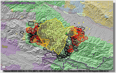
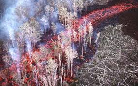
Forest Fire Hazard Zone mapping
Forest Fire Hazard Zone Mapping: Forest is one of the essential elements of nature. It plays a vital role for the local climate. Forest fires caused extensive damage to our communities and environmental resource base. GIS can effectively use for the forest fire hazard zone mapping and also for the loss estimation. GIS also helps to capture the real-time monitoring of fire-prone areas. This is achieved by the help of GNSS and satellite Remote Sensing.

Pest control and management
Pest Control and Management: Pest control helps in agricultural production. Increasing the rate of pest and weeds can lead to a decrease in crop production. Therefore GIS plays an vital role to map out infested areas. This leads to the development of weed and pest management plan.
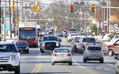
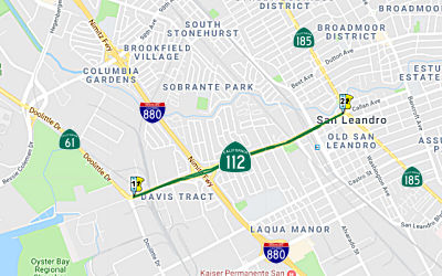
Traffic density studies
Traffic Density Studies: GIS can effectively use for the management of traffic problems. Today’s population, along with the road traffic, is increasing exponentially. The advantage of GIS makes it an attractive option to be used to face the emerging traffic problems. By creating an extensive database that has all the traffic information such as speed data, road geometry, traffic flow, and other spatial data and processing this information will provide us the graphical bigger picture for the traffic management.
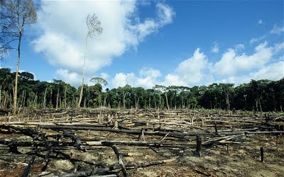
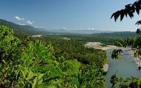
Deforestation
Deforestation: Nowadays forest area is decreasing every year, due to different activities. GIS is used to indicate the degree of deforestation and vital causes for the deforestation process. GIS is used to monitor deforestation.

Space utilization
Space Utilization: GIS helps managers to organize and spatially visualize space and how it can best be used. Operational costs can be decreased by more efficiently using space, including managing the moves of personnel and assets as well as the storage materials. The 3D visualization in GIS platforms helps planers to create a feeling of experience like a virtual walk inside the building and rooms before construction.

GIS for Business
GIS for Business: GIS is also used for managing business information based on its location. GIS can keep track of where the customers are located, site business, target marketing campaigns, and optimize sales territories and model retail spending patterns. Such an added advantage is provided by the GIS to enhance in making companies more competitive and successful. (Sita Mishra, GIS in Indian Retail Industry-A Strategic Tool)

Utilities
Utilities: The GIS is used for a different type of utilities like electricity, telecom and cooking gas on a daily basis and utilities to help them in mapping, in inventory systems, track maintenance, monitor regulatory compliance or model distribution analysis, transformer analysis and load analysis.

Lease property and management
Lease Property and Management: Revenue can be increased, operations and maintenance cost can be reduced when GIS is used to help manage space. Real estate and property managers can see and make queries about area, including its availability, size, and unique constraints for the most cost-effective use.

Development of public infrastructure facilities
Development of Public Infrastructure Facilities: GIS has many uses and advantages in the field of facility management. GIS can be used by facility managers for space management, visualization and planning, emergency and disaster planning and response. It can be used throughout the life cycle of a facility from deciding where to build to space planning. Also, it allows for better planning and analysis.
Collection of information about geographic features
Collection of Information about Geographic Features: GIS is not merely a computer system used for making maps. A map is simply the most common way of reporting information from a GIS database. So these systems are not only for creating maps but also most importantly the collection of information about the geographic features such as building, roads, pipes, streams, ponds and many more that are located in your community.

GIS for public health
GIS for Public Health: GIS provides a cost-effective tool for evaluating interventions and policies potentially affecting health outcomes. GIS analysis, environmental health data is also helpful in explaining disease patterns of relationships with the social, institutional, technological, and natural environment. It can understand the complicated spatial, temporal relationship between environmental pollution and disease, and identifying exposures to environmental hazards. GIS can significantly add value to environmental and public health data.
Location Identification
Location Identification: This technique is used to find a location for a new retail outlet. It helps to find out what exists at a particular site. An area can be described in many ways, using, for instance, name of a place, postcode, or geographic references such as longitude or latitude or X/Y.
A knowledge-based system for Defense purpose
Knowledge-Based System for Defense Purpose: Regular analysis of terrain is essential for today’s fast-paced battlefield. A conventional method of studying paper topographical maps is being replaced by the use of maps in digital form to get terrain information. It is increasingly being used to derive terrain information from digital images, which help to the selection of suitable sites for various military uses more accurate and faster. The uses of GIS provide information regarding the terrain features, which can be useful for planning today’s war strategies.
Pipeline route selection
Pipeline Route Selection: Pipeline route planning and selection is usually a complicated task. GIS technology is faster, better, and more efficient in this complex task. Accurate pipeline route selection brings about risk and cost reduction as well as a better decision-making process. GIS least-cost path analysis has been effectively used to determine suitable oil and gas pipeline routes. An optimal route will minimize reduce economic loss and negative socio-environmental impacts.
Producing mailing labels for abutter notification
Producing Mailing Labels for abutter Notification: Zoning board of appeals hearings or proposed action by a town or city require notifying abutting property owners. A GIS application for producing abutter mailing labels enables you to identify abutting property owners are in different ways. Once the properties are identified this kind of GIS applications can create mailing labels and be integrated with a word processing “mail merge “capabilities.
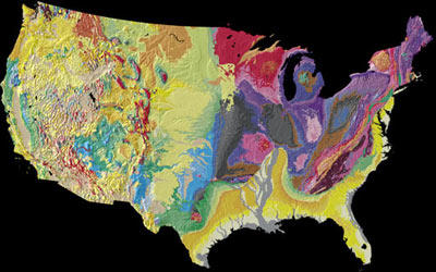
Geologic mapping
Geologic Mapping: GIS is a useful tool in geological mapping. It becomes easy for surveyors to create 3D maps of any area with precise and desired to scale. The results provide accurate measurements, which helps in several fields where the geological map is required. This is cost-effective and offers more accurate data, thereby easing the scaling process when studying geologic mapping.

Environment
Environment: The GIS is used every day to help protect the environment. The environmental professional uses GIS to produce maps, inventory species, measure ecological impact, or trace pollutants. The aenvironmental applications for GIS are almost endless. It can be used to monitor the environment and analyze changes.

Infrastructure development
Infrastructure Development: Advancement and availability of technology have set a new mark for professionals in the infrastructure development area. Now more and more professionals are seeking the help of these technologically smart and improved information systems like GIS for infrastructure development. Each and every phase of the infrastructure life cycle is greatly affected and enhanced by the enrollment of GIS.
Coastal development and management
Coastal Development and Management: The coastal zone represents a varied and highly productive ecosystem such as mangrove, coral reefs, seagrasses, and sand dunes. GIS could be generating data required for macro and micro level planning of coastal zone management. GIS could be used in creating baseline inventory of mapping and monitoring coastal resources, selecting sites for brackish water aquaculture, studying coastal landforms.

Crime analysis
Crime Analysis: GIS is a necessary tool for crime mapping in law enforcement agencies worldwide. Crime mapping is a critical component of crime analysis. Satellite images can display relevant information about criminal activities. The efficiency and the speed of the GIS analysis will increase the capabilities of crime-fighting.
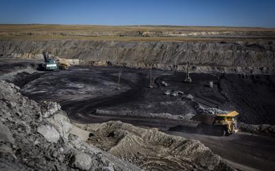
Land-use changes associated with open cast strip mining
Land Use Changes Associated with Open Cast Strip Mining: Mining is the backbone of the developing economy of any country. Mapping, monitoring, and controlling the impact caused by the mining activities is necessary so as to understand the character and magnitude of these hazardous events in an area. The data required to understand the impact of mining from the environment is coming from a different discipline, which need integration in order to arrive at hazard map zonation.
Economic development
Economic Development: GIS technology is a valuable tool used for economic development. It helps in site selection, suitability analysis, and for finding the right sites to locate new business and grow existing ones. Within economic development, GIS is used to support the emerging trend of economic gardening, a new way to foster local and regional economic growth by existing small business in the community.
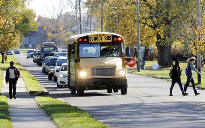
School student walking distance analysis
School Student Walking Distance Analysis: If your community buses students to school, but only if they lived beyond a certain distance from their school, this could be used to determine what addresses are eligible for busing.
Locating underground pipes and cables
Locating Underground Pipes and Cables: Pipeline and cable location is essential for leak detection. It can be used to understand your water network, conducting repairs and adjustments, locating leaks known the distance for correlating, etc. Pipelines are continually monitored, check for leak detection, and avoid the problem of geohazards.
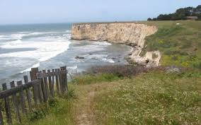
Coastal vegetation mapping and conservation
Coastal Vegetation Mapping and Conservation: Coastal vegetation like Mangroves are the protectors of the coast from natural hazards like a tsunami so that the conservation of this vegetation is highly essential. GIS enables us to map which are having a higher density of vegetation and which area need more vegetated? Integration of these details to coastal zone mapping helps to identify the area prone to coastal erosion, and we can plant more vegetation to reduce coastal erosion.
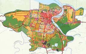
Regional planning
Regional Planning: Every day, planners use Geographic Information System (GIS) technology to research, develop, implement, and monitor the progress of their plans. GIS provides planners, surveyors, and engineers with the tools they need to design and map their neighborhoods and cities. Planners have the technical expertise, political savvy, and fiscal understanding to transform a vision of tomorrow into a strategic action plan for today, and they use GIS to facilitate the decision-making process. (ESRI, GIS Solutions for Urban and Regional Planning)

GIS for Land Administration
GIS for Land Administration: In a number of countries, the separate functions of land administration are being drawn together through the creation of digital cadastral databases, with these databases they can reuse land for suitable needs, digital taxation and even utilities are also easily handle using these databases.
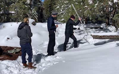
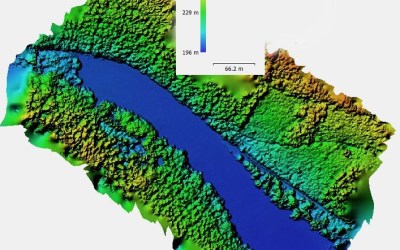
Snow cover mapping and runoff prediction.
Snow Cover Mapping and Runoff Prediction: Systematic, periodical and precise snow cover mapping supported by GIS technology, and the organization of the results in a snow cover information system form the basis for a wide range of applications. On the practical side, these applications are related to the monitoring of seasonal and yearly alterations of the snow cover under the presently existing climatic conditions, to simulate and forecast runoff, to map the regional distribution of the water equivalent, and to document the recession process of the snow cover during the melting period in its relation to geological features.
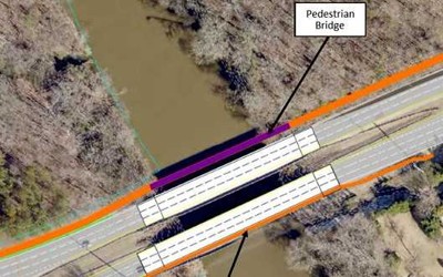
River crossing site selection for Bridges
River Crossing Site Selection for Bridges: The important geotechnical consideration is the stability of slope leading down to and up from the water crossing. It is advisable to collect historical data on erosion and sedimentation. On the basis of these information asses the amount of river channel contraction, degree of curvature of a river bend, nature of bed and bank materials including the flood flow and the flow depth, all these can be done in GIS within the estimated time and accurately. This information has been often used for river crossing site selection for bridges.
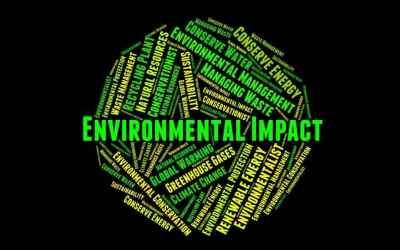
Environmental Impact Analysis
EIA is an important policy initiative to conserve natural resources and the environment. Many human activities produce potential adverse ecological effects, which include the construction and operation of highways, railroads, pipelines, airports, radioactive waste disposal, and more. Environmental impact statements are usually required to contain specific information on the magnitude and characteristics of environmental impact. The EIA can be carried out efficiently by the help of GIS, by integrating various GIS layers, assessment of natural features can be performed.
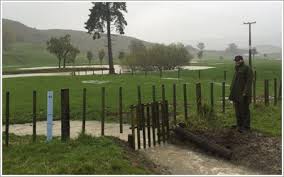
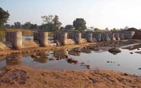
GIS for Drainage problems in tea plantation areas
GIS for Drainage Problems in Tea Plantation Areas: Drainage problem in tea plantation differ widely because of its varied nature of physical conditions. Tea crop requires moisture at adequate levels all times of its growth. Any variation, either excess or lack, has a direct impact on the tea yield. This becomes greatly influenced the productivity of tea. Required some hydraulic design to solve this problem such as the design of drains, checking the adequacy of the river and classification of waterlogged areas, etc. A GIS helps to reduce the water logging by establishing well-developed plans.

Disaster and Business continuity planning
Disaster and Business Continuity Planning: Viewing building and locations assets along with emergency information such as weather patterns, and disaster zones, can provide organizations the required information to make a better decision. GIS provides a holistic understanding of facility status and performance and brings together department, business systems, and data source for a comprehensive view into and throughout the organization. (Faisal I. Al-Shukri, GIS Utilization in Facility Management)
Assets management and maintenance
Assets Management and Maintenance: GIS helps organizations to gain efficiency even in the face of finite resources and the need to hold down the cost. Knowing the population at risk enables planners to determine where to allocate and locate resources more effectively. Operations and maintenance staff can deploy enterprise and mobile workforce. GIS build mobile applications that provide timely information in the field faster and more accurate work order processing.
GIS for planning and community development
GIS for Planning and Community Development: GIS helps us to understand our world better so we can meet global challenges. Today GIS technology is advancing rapidly, providing many new capabilities and innovations in planning. By applying a known part of science and GIS to solve unknown part, that helps to enhance the quality of life and achieve a better future. Creating and using GIS tools and knowledge allow us to integrate geographic intelligence into how we think and behave.
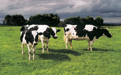
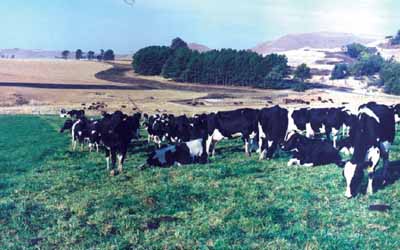
GIS in diary Industry
GIS in Dairy Industry: Geographic Information System is used in various application in the dairy industry, such as the distribution of products, production rate, location of shops, and their selling rate. These can be monitored by using the GIS system. It can also be possible to understand the demand for milk and milk products in a different region. GIS can prove to be a useful tool for planning and decision making for any dairy industry. These advantages have added new vistas in the field of dairy farm and management.
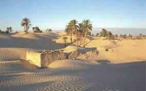
Desertification
Desertification: Desertification is land degradation due to climatic variations or human activities. GIS can provide the information on degraded land which can be managed by governmental agencies or by the communities themselves. GIS plays a vital role to reduce desertification. The local governments now widely depend on GIS for reducing desertification. With location-based GIS analysis, we can find where or which area is suitable for planting new vegetation and which field for the pipeline construction.
Volcanic hazard identification
Volcanic Hazard Identification: Volcanic hazard to human life and environment include hot avalanches, hot particles gas clouds, lava flows, and flooding. Potential volcanic hazard zone can be recognized by the characteristic historical records of volcanic activities. It can incorporate with GIS. Thus an impact assessment study on volcanic hazards deals with economic loss and loss of lives and property in densely populated areas. The GIS-based platforms enable us to find out the damage, and rapid response against volcanic activities may help to reduce the effect in terms of wealth and health of people.

Tourism information system
Tourism Information System: GIS provides a valuable toolbox of techniques and technologies of broad applicability to the achievement of sustainable tourism development. This provides an ideal platform-tools required to generate a better understanding and can serve the needs of tourists. They will get all the information on click, measure distance, find hotels, restaurant, and even navigate to their respective links. Data plays a vital role for tourists in planning their travel from one place to another, and the success of the tourism industry. This can bring many advantages for both tourist and tourism department.
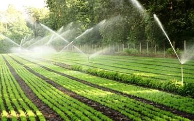
Irrigation water management
Irrigation water management: Water availability for irrigation purposes for any area is vital for crop production in that region. It needs to be appropriately and efficiently managed for the proper utilization of water. To evaluate the irrigation performance, integrated use of satellite remote sensing and GIS assisted by ground information has been found to be an efficient technique in spatial and time domain for identification of major crops and their conditions, and determination of their areal extent and yield. Irrigation requirements of the crop were determined by considering the factors such as evapotranspiration, Net Irrigation Requirement, Field irrigation Requirement, Gross Irrigation Requirement, and month total volume of water required, by organizing them in the GIS environment.
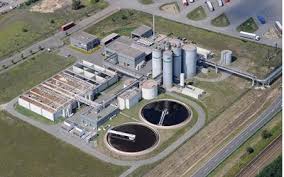
Site suitability for the waste treatment plant
Site Suitability for Waste Treatment Plant: There is an increasing amount of waste due to the overpopulation growth. This has a negative impact on the environment. With the help of GIS, we can integrate various aspect layers in GIS and can identify which place is suitable for the waste treatment plant. This process will reduce the time, and it is cost-effective. Also, it enhances accuracy. It provides a GIS analyst to identify a list of suitable dumping sites for further investigations. It also provides a digital bank for future monitoring program of the site.
Landslide Hazard Zonation using GIS
Landslide hazard zonation is the process of ranking different parts of an area according to the degrees of actual or potential hazard from landslides. The evaluation of landslide hazard is a complicated task. It has become possible to efficiently collect, manipulate, and integrate a variety of spatial data such as geological, structural, surface cover and slope characteristics of an area, which can be used for hazard zonation. The entire above-said layer can well integrate using GIS, and weighted analysis is also helpful to find a Landslide prone area. By the help of GIS, we can do a risk assessment and can reduce the losses of life and property.

land use/land cover changes
Landcover means the feature that is covering the barren surface. Land use means the area in the surface utilized for a particular purpose. The role of GIS technology in land use and land cover applications is that we can determine land use/land cover changes in different areas. Also, it can detect and estimate the changes in land use/ land cover pattern within time. It enables to find out sudden changes in land use and land cover either by natural forces or by other activities like deforestation.
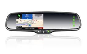
Navigation (routing and scheduling)
Web-based navigation maps encourage safe navigation in the waterway. Ferry paths and shipping routes are identified for better routing. ArcGIS supports secure navigation system and provides accurate topographic and hydrographic data. Recently DNR, s Coastal Resources Division began the task of locating, documenting, and cataloging these no historic wrecks with GIS. This division is providing public information that makes citizens aware of these vessel locations through a web map. The web map will be regularly updated to keep the boating public informed of these coastal hazards to minimize the risk of collision and injury.

GIS for Wildlife Management
GIS for Wildlife Management: Man-made destruction such as habitat loss, pollution, invasive species introduction, and climate change, are all threats to wildlife health and biodiversity. GIS technology is a useful tool for managing, analyzing, and visualizing wildlife data to target areas where international management practices are needed and to monitor their effectiveness. A GIS helps wildlife management professionals examine and envision.