Our Solutions
Election Solutions
Introduction
Mapping technology is central to effective elections. From redistricting to campaigning to election day itself, GIS powers the operations that drive this essential democratic process.
Today, GIS goes far beyond election logistics to enable productive collaboration via informative, interactive maps. It’s easier than ever to leverage your existing GIS resources to create easy-to-use applications that give officials, candidates, citizens, and the media a powerful new platform on which to visualize and discuss the electoral process.
GIS provides easy applications that give officials, candidates, citizens, and the media powerful tools to visualize, interact and plan the electoral process. Easy access to poll information at any one time involving participation of all stake holders leads to higher voter turnout and confidence in the elections results. GIS integrates geospatial services in the cloud, realtime data, user generated content, mobile applications, and social networks to avail the information promoting open election practices that leaders and citizens expect.


Managing Elections
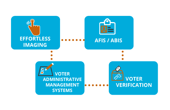
GIS brings efficiency and accuracy to every step of the internal elections cycle:
 Registering voters and managing voter data, including geocoded information
Providing easy access to information on elected officials and precincts throughout the year
Redrawing boundaries, enabling public redistricting input, and disclosing precinct maps along with relevant demographic data
Determining optimal polling locations and publicizing poll and precinct information
Coordinating with precincts on election day
Delivering election results, including real-time, temporal displays
Engaging Citizens
States, countries, cities, and the media are increasingly leveraging GIS to create compelling applications that:
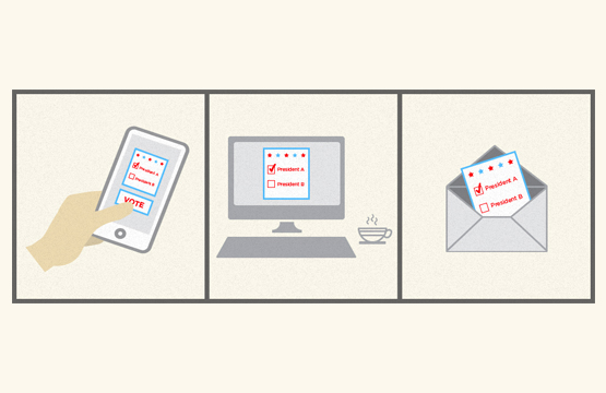
Help voters find their way to the polls on election day through searchable maps, offering poll locations, voting hours, driving directions, and other details.
Share election results in real time on interactive maps.
Open the redistricting process to the public by providing tools to create, propose, and evaluate redistricting plans.
Give citizens year-round access to information on elected officials, voter registration, and precincts.

Manage Campaigns
GIS brings efficiency and accuracy to every step of the internal elections cycle:
The efficiency and success of your campaign hinges on knowing your electorate. It will help you better understand and target voters all the way down to the block group geography level. This knowledge enables you to direct your campaign messages to the right audiences, plan events in the right areas, and segment voters for fundraising, saving you valuable time and money during the short campaign season.
If you don't have a GIS in place, Community Analyst make it easy to analyze hundreds of demographic and lifestyle factors, including key traits such as likelihood to vote or work for a political candidate.
Redistricting and Precinct Allocation
Once you have the data you need for redistricting, continue to make the most of it throughout the year. With GIS you can manage and update voter data, including constituent information, and spatially analyze issues for improved decision making.
Use GIS to better understand the factors at work in a region, improve collaboration, and provide optimal districts.