The Overview

Introduction
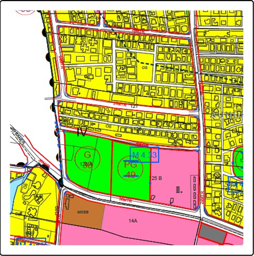
The Town Planning Department wanted to undergo a Major Digital Transformation Project where they intend to change the Paper Maps scanned certificate to GIS Maps. Citizens would get old Paper Scan Map as Record of Land ownership instead of GIS Maps , which resulted in Boundary Dispute and other legal hurdles going over that particular piece of land.
SOLUTIONS
Secured balanced and planned development of the urban areas have now become the order of the day. Conversion of Draft Town Planning Schemes into Final Town Planning schemes requires systematic and meticulous utilization of land parcels for the benefit of the people. Digital representation of all Town Planning Schemes through a centralized GISenabled web platform shall help urban planners and citizens for the transparent representation of records for all purposes.
The citizens in an urban local body (ULB) require site plans of Survey Nos. and Zone certificate for their different purposes such as legal, transfer, etc. This is a manual and the laborious process to provide Issuance of Site/Part Plan and Zone Certificate.
Creation of web-based GIS solution we can impose digital transformation to bring in agility in the complete process with an increase in turnaround time and revenue.
GIS maps created of DP, GP, and RP with growth centres to provide latest technology decision and communication module.
It will provide ease for the citizens hasslefree solutions without them visiting the offices and tolling on the footfall at ULB offices. Issuance of certificates from the portal and reduced footfall of citizens to visit Town planning office.
RESULTS
Citizen receive new Building Permit Map Certificate within 1 Minutes instead of existing 7 days because of manual process of Scan & Editing Paper Maps.
